
Using Surface Features to Locate Underground Utilities
Locating underground utilities primarily focuses around using locating equipment to markout and map what’s underneath the surface. These utilities are usually unable to be seen without performing a bit of digging. But what about what we can see? Surface features are a big part of utility locating. How can they help us determine what’s underneath the surface?
What Are Utility Surface Features?
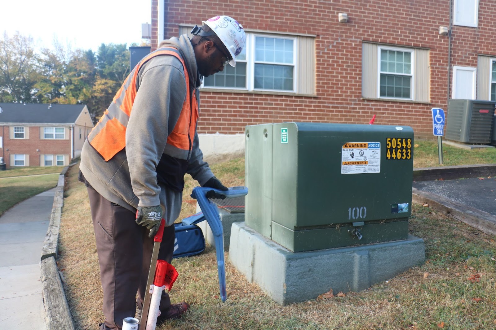
Surface features are exactly what they sound like – indicators of underground utilities that can be seen from the surface. Surface features are usually utility access points that can be used for facility maintenance. Manholes, sewer inlets, electrical boxes, light poles, and fire hydrants can be considered surface features. Many gas pipelines, for example, have non-active poles that signify the existence of an underground gas line so people working in the area are aware of the dangers of digging.
The Importance of Surface Features
These surface features can be important for many reasons, but most importantly, they point to an area you shouldn’t dig without locating existing utility lines. As mentioned in a previous blog post about the depth of utility lines, digging or excavation around a surface feature is generally a bad idea without utility locating. There’s a whole subsurface utility engineering data level for identifying surface features on sites, known as Quality Level C data. While they won’t give you the full picture of what lies below, they indicate that something could exist under the surface prior to any electromagnetic or ground penetrating radar scans. The accessibility of surface features also helps with utility locating more than just being an indicator. Connecting a transmitter to a light pole or electrical box can send a specific electromagnetic frequency through an electrical line. This is known as a direct connection. The strengthened signal can be easily traced with electromagnetic locating equipment that may not be as easily detected in passive scanning.

Surface features can also provide easy pipe access. Opening up a manhole can reveal the multiple directions pipes travel in from a single point, opening up possibilities for further investigations. Some manholes can reveal pipes going in more than five directions. If a pipe is difficult to trace (due to the pipe material and/or lack of tracer wire), a tracer rod can be run through a manhole and pushed through the line to make locating much easier.
Uncovering Missing Surface Features
What if a surface feature can’t be located? It may seem crazy, but some surface features can go missing, only appearing on as-built plans but not locatable with eyes alone. This occasionally happens with sewer manholes that are parts of a larger system in unmaintained areas where dirt and overgrowth buries the manhole. Can it really be considered a surface feature if it can’t be seen from the surface? Thankfully, there is a way to investigate this as well – using CCTV video pipe inspection equipment, a pipe crawler can be sent through a nearby accessible manhole and pan the camera towards the surface to find any missing access points if they exist. If you need mapping of existing utilities for your site, our team at Trinity Subsurface provides full service subsurface utility investigations. We use a variety of tools and methods to examine your scope of work prior to construction or excavation, including EM / GPR scanning, vacuum excavation, and CCTV pipe inspections. Check out the rest of our website to find out more information on how we can investigate your next project.


