Locate private underground utilities, foreign objects, and anomalies.

Do you need to update blueprints for new building construction or utility installation? Locate lines before you design! Protecting utilities starts with site investigations and specialty equipment.

Electromagnetic equipment is effective at locating metallic utilities up to 15 feet below the surface including:
The EM equipment consists of a transmitter and receiver. The transmitter applies a signal, set to a specific frequency, to a metallic line for the receiver to pick up.

The duct rodder has a tracing cable embedded within the fiberglass rod for quick utility locating without digging or trenching. The copper wire is energized with an electromagnetic signal.
When the energized duct rodder is pushed into the underground pipe, the signal radiates outward through the soil to the surface. A signal receiver detects the frequency applied, allowing the entire buried utility pipe to be traced and marked.

All project sites are scanned with an Aquatronics A6 Split-Box locating device. This device emits an electromagnetic frequency to locate:
The Split-Box is a hand-held instrument, consisting of a transmitter and a receiver. The instrument traces underground conductive networks. The split box is crucial to detect underground structures when no surface features are present.

Ground penetrating radar aids in the confirmation of metallic targets and is capable of detecting non-metallic lines such as:
The GPR cart sends continuous electromagnetic pulses through the earth, then receives the reflected waves back from the subsurface structures. The results construct an image of the subsurface structures which is marked out by the field employee.
Pinpoint buried utilities with a 24-hour field sketch turn-a-round. Submit your contact info to see how user-friendly our deliverables are for project managers, foremen, and engineers alike. Trinity Subsurface can provide utility mapping in a PDF, CAD, or GIS format.
Next Step: determine the exact depth and confirm detected utilities with vacuum excavation.
Learn More >Next Step: conduct a thorough cleanout of found utility lines.
Learn More >Next step: map untraceable sewer or storm laterals.
Learn More >Next step: discover a leak source found on a utility locate.
Learn More >Next step: complete survey-grade mapping of utility mark outs.
Learn More >The number one risk to construction workers is caused by excavating and drilling around underground utilities and unexploded ordnances.
Breaking ground blind will lead to costly utility repairs and possible state fines. Locate all utilities within the project scope to avoid accidental strikes. Keep your construction project on time and on budget by preventing site damage.
Utility location is a great preventative measure to avoid strikes during excavation. Trinity promises speedy service response, catered to your project timeline.

A private utility is an utility that is not owned by a utility company. While public utilities up to the meter can be marked via 811 or Miss Utility, you are responsible for maintaining and locating private lines. Trinity Subsurface, LLC can locate all private utilities on-site.
Anyone breaking ground is required by law to notify Call 811 in advance of excavation. Only 68% of the underground utilities are owned by a public utility company, leaving the remaining 32% to private utility owners who may not know about 811 or Miss Utility.
The percentage of unmarked utilities dramatically increases when working on private property or private campuses including:
- Hospitals
- Universities
- Industrial Facilities
- Airports
- Military Sites
Electromagnetic equipment is effective at locating metallic utilities such as metallic water pipes, electric cables, telephone cables, and metallic gas pipes to a depth of up to 15 feet. Using a traceable duct rod and sonde field employees can locate storm and sewer lines with breaks and blockages as well as pinpoint empty conduits. We can also use full polarization ground penetrating radar and ultra-wideband electromagnetic induction to locate unexploded ordnances.
We will also use a split box or Aquatronics tracer to confirm utilities, metal tanks, manhole lids, and reinforced slabs. Ground penetrating radar is used to aid in the confirmation of electromagnetic targets, and to designate the location of utilities and structures that were not detected using electromagnetic techniques.
The depth at which a utility can be detected is dependent on a combination of the size and material composition of the utility, the depth of the utility, the conductivity of the utility, and the material composition of the back-fill and earth materials surrounding the utility.
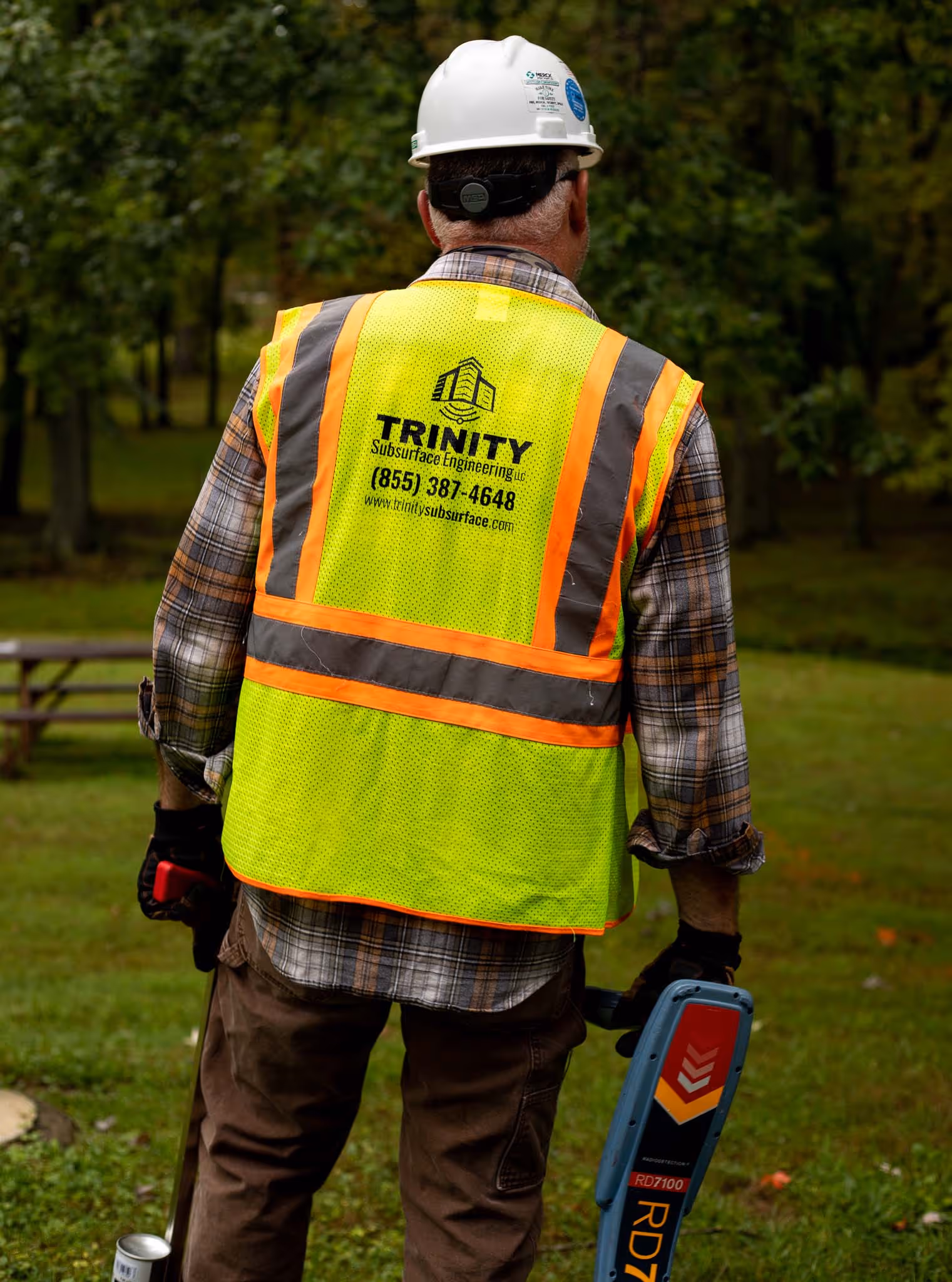
Trinity Subsurface, LLC field employees has a range of geophysical equipment utilized for private utility location. If the project scope extends past the limitations of typical locating, our team has access to additional technologies to resolve any mapping issues.
In addition to a superior utility mark out using paint and flags, we provide our clients with the documentation needed to proceed with construction.
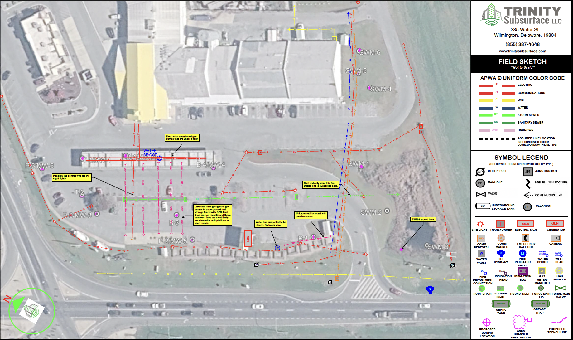
Trinity Subsurface, LLC generates a field report, documenting survey dates, utilities designated, equipment utilized, site contacts made, and any limitations or unusual field conditions encountered while performing the work. Our field employees also draft a field sketch, depicting the underground utilities found or verified.
The field sketch will be formatted on our 11″x17″ sketch template using a Google satellite image of the work area. Need a construction drawing updated? A field sketch can overlay any client-provided PDF document.